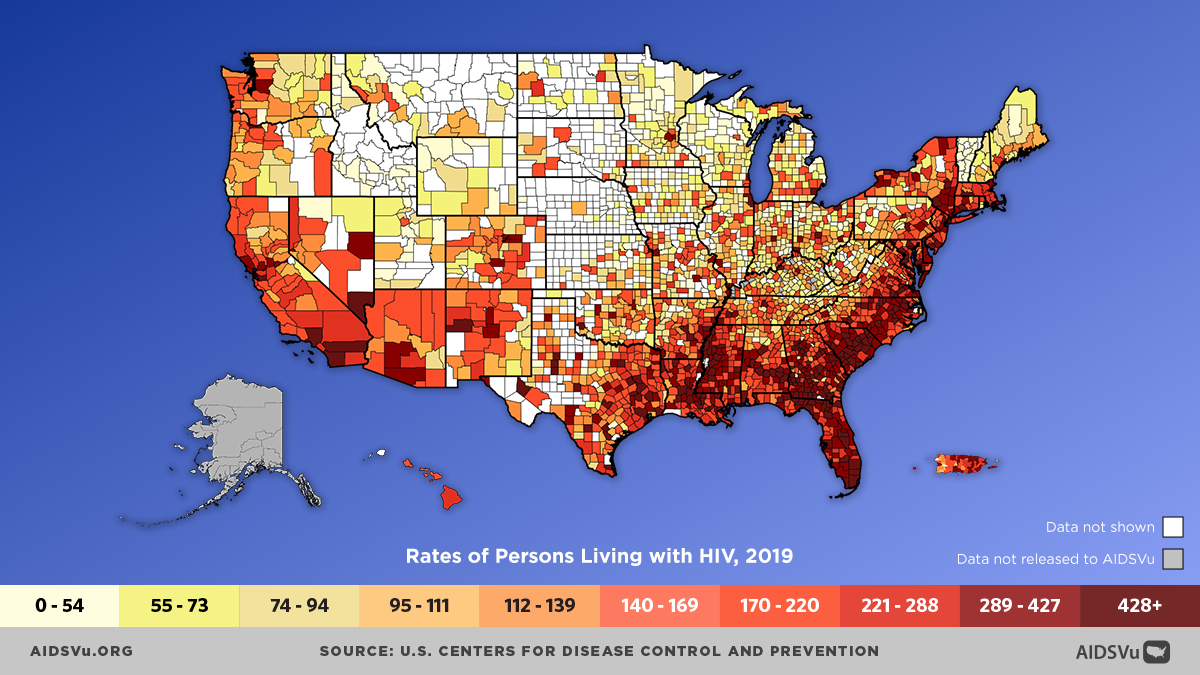
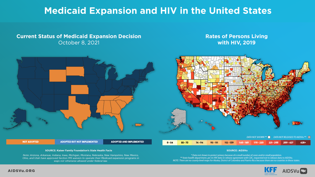
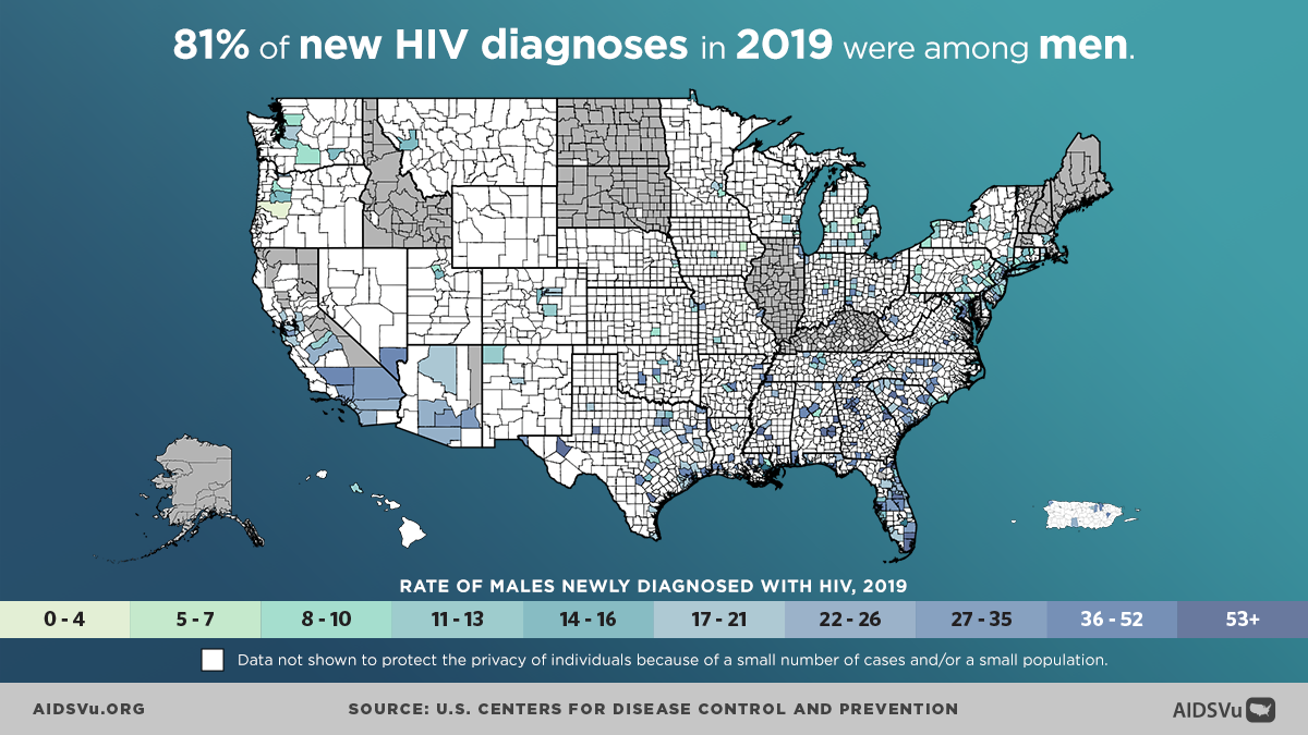
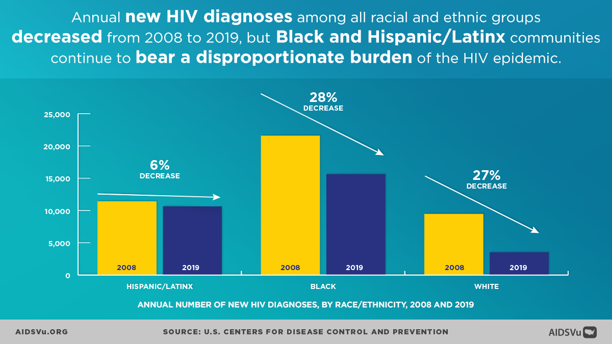
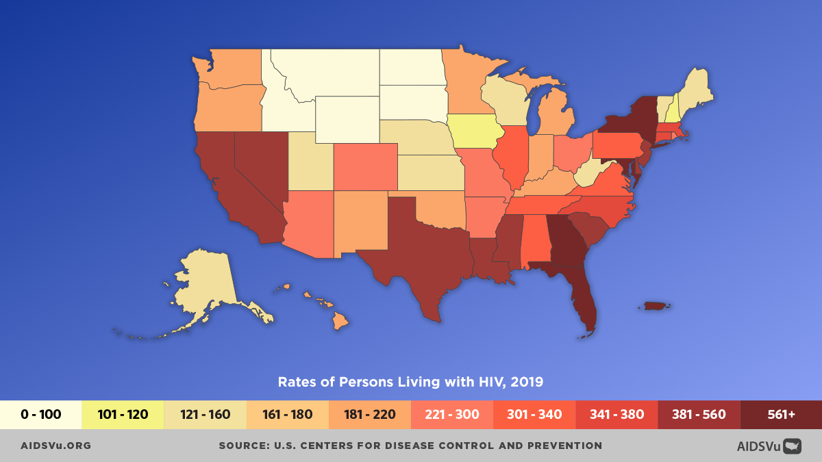
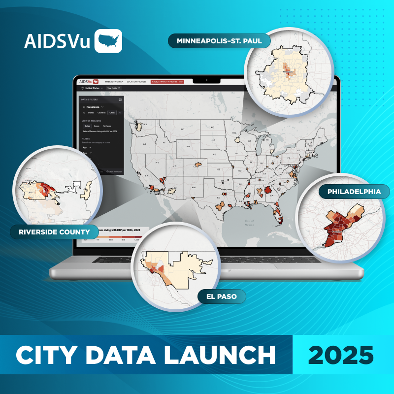
ATLANTA – December 15, 2021 – AIDSVu today released interactive maps and data visualizing the HIV epidemic at the state and county level for 2019, and for 15 additional cities across the United States, further illustrating how the HIV epidemic impacts cities and neighborhoods at a fine geographic level to enable targeted and effective policy and programmatic interventions. In addition to the 2019 county- and state-level prevalence and new diagnoses maps, as well as state-level HIV care continuum maps, AIDSVu is excited to update several cities to 2019 data, and add Orange County, CA for the first time, bringing the total number of cities mapped at the ZIP Code-level to more than 50.
These maps are a snapshot of the state of HIV in the year before the COVID-19 epidemic, which has had a profound impact on allocation of resources, testing, new diagnoses, and data collection over the last two years.
In collaboration with health departments across the country, AIDSVu continues to visualize steps of the HIV care continuum, including new diagnoses, late diagnoses, linkage to care, receipt of care, and viral suppression, as data and interactive maps for 36 cities. These interactive maps can be viewed across different demographic groups such as age, sex, and race/ethnicity, as well as alongside social determinants of health and overlaid with HIV testing, PrEP, and care service locations.
“Every year when we update our state- and county-level maps we gain a greater understanding of the HIV epidemic in the United States. Visualizing these data helps draw attention to underserved communities and geographic regions and helps policymakers and public health officials to make informed decisions about resource allocation. This is especially important now, as the COVID-19 pandemic continues to impact other infectious diseases such as HIV and Hepatitis C,” said Patrick Sullivan, DVM, PhD, Professor of Epidemiology at Emory University’s Rollins School of Public Health and Principal Scientist for AIDSVu.
Major data updates this year include:
- 2019 state- and county-level HIV prevalence and new diagnoses maps.
- ZIP Code-level maps showing HIV prevalence (2019) and new diagnoses data (cumulative 2015 to 2019) for 15 additional U.S. cities, bring the total number of cities on AIDSVu to 50.
- Updated cities in this release include Atlanta, GA, Austin, TX, Dallas, TX, Denver, CO, Fort Worth, TX, Houston, TX, Los Angeles, CA, Memphis, TN, Nashville, TN, New York, NY, Oakland/Alameda, CA, Orange County, CA, San Antonio, TX, and San Diego, CA.
- ZIP Code-level maps showing late HIV diagnoses (cumulative 2015 to 2019), linked to HIV care (cumulative 2015 to 2019), receipt of HIV care (2019), and viral HIV suppression (2019) for more than 35 U.S. cities.
- Enhanced and updated data profile pages, that are easy to download and print at the national, regional, state, county, and city levels.
- Updated HIV maps alongside maps of social determinants of health – such as poverty (2019), high school education (2019), median household income (2019), income inequality (2019), and people without health insurance (2019).
AIDSVu is presented by Emory University’s Rollins School of Public Health in partnership with Gilead Sciences, Inc. and the Center for AIDS Research at Emory University (CFAR). Now in its eleventh year, AIDSVu continues to advance its mission to make HIV data widely available, easily accessible, and locally relevant to inform public health decision-making and action. The site aims to provide researchers, policymakers, and community members with a more comprehensive understanding of the HIV epidemic at the local-, state-, and national- level.
ZIP Code, census tract, and community area/ward data were provided by state and city health departments and compiled by researchers at the Rollins School of Public Health. Learn more about AIDSVu’s HIV care continuum data and sources, see our FAQ and Data Methods.

